Category:Duffield, Derbyshire
Jump to navigation
Jump to search
village and civil parish in Amber Valley district, Derbyshire, England  | |||||
| Upload media | |||||
| Instance of | |||||
|---|---|---|---|---|---|
| Location | Amber Valley, Derbyshire, East Midlands, England | ||||
| Area |
| ||||
| Different from | |||||
| Said to be the same as | Duffield (Wikimedia duplicated page, civil parish) | ||||
 | |||||
Subcategories
This category has the following 9 subcategories, out of 9 total.
- Duffield Castle (10 F)
A
B
- Burley Hill (18 F)
D
- Duffield Bridge (2 F)
- Duffield railway station (58 F)
- Duffield War Memorial (1 F)
H
- Duffield Hall, Derbyshire (3 F)
J
Media in category "Duffield, Derbyshire"
The following 200 files are in this category, out of 208 total.
(previous page) (next page)-
 A beer bottle bobs in the Derwent - geograph.org.uk - 2385193.jpg 427 × 640; 136 KB
-
 A Coates, Traditional Butcher - geograph.org.uk - 2385451.jpg 640 × 427; 97 KB
-
 A fast flow on the Derwent - geograph.org.uk - 2385198.jpg 640 × 427; 132 KB
-
 A patch of scum - geograph.org.uk - 2385413.jpg 427 × 640; 125 KB
-
 A swan on the Derwent - geograph.org.uk - 2385196.jpg 640 × 427; 131 KB
-
 Abandoned flip-flops - geograph.org.uk - 2384499.jpg 427 × 640; 134 KB
-
 Allestree Hall, aerial 2014 - geograph.org.uk - 3926271.jpg 1,024 × 683; 208 KB
-
 Allestree Hall, aerial 2014 - geograph.org.uk - 3926276.jpg 1,024 × 683; 147 KB
-
 Bench beside the Derwent - geograph.org.uk - 2384658.jpg 640 × 427; 103 KB
-
 Benz-Bavarian car sales at Flaxholme - geograph.org.uk - 4330145.jpg 1,565 × 1,563; 714 KB
-
 Branch Library, Duffield - geograph.org.uk - 2194804.jpg 800 × 600; 120 KB
-
 Bridge and Saint Alkmunds, Duffield - geograph.org.uk - 2802650.jpg 1,600 × 1,156; 165 KB
-
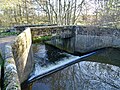 Bridge and weir on the River Ecclesbourne - geograph.org.uk - 5205019.jpg 1,280 × 960; 573 KB
-
 Broadway Duffield - geograph.org.uk - 5560250.jpg 2,000 × 1,333; 3.41 MB
-
 Broadway Duffield - geograph.org.uk - 5560259.jpg 2,000 × 1,333; 3.31 MB
-
 Broken willow beside the Derwent - geograph.org.uk - 2384391.jpg 640 × 427; 119 KB
-
 Burley Hill north of Allestree (1) - geograph.org.uk - 6359266.jpg 1,024 × 768; 154 KB
-
 Burleywood Farm - geograph.org.uk - 2195829.jpg 3,648 × 2,736; 4.95 MB
-
 Burleywood Farm, Quarndon, Derbyshire - geograph.org.uk - 1817490.jpg 1,600 × 1,200; 253 KB
-
 Bus stop and shelter by A6 south of Duffield - geograph.org.uk - 5535009.jpg 1,600 × 1,279; 848 KB
-
 Cavendish Close, Duffield - geograph.org.uk - 6363307.jpg 1,024 × 768; 209 KB
-
 Chapel Lane, Duffield - geograph.org.uk - 2119828.jpg 640 × 480; 94 KB
-
 Chevin Golf Course - geograph.org.uk - 4759381.jpg 640 × 360; 44 KB
-
 Church on the A6 - geograph.org.uk - 2195836.jpg 3,648 × 2,736; 4.23 MB
-
 Clubhouse and First Tee at Chevin Golf Club - geograph.org.uk - 3942729.jpg 4,000 × 3,000; 1.74 MB
-
 Cooperative shop, Town Street, Duffield - geograph.org.uk - 5535015.jpg 1,600 × 1,200; 822 KB
-
 Cross Country at St Alkmund's, Duffield.jpg 2,000 × 3,008; 3.08 MB
-
 Crown Street in Duffield - geograph.org.uk - 3492648.jpg 3,920 × 2,892; 2.13 MB
-
 Cumberhills Road - geograph.org.uk - 5560272.jpg 2,000 × 1,333; 2.3 MB
-
 Cumberhills Road near Duffield - geograph.org.uk - 3941298.jpg 4,000 × 3,000; 1.97 MB
-
 Curzon Lane, Duffield - geograph.org.uk - 6363301.jpg 1,024 × 768; 133 KB
-
 D7629 - Ecclesbourne Valley Railway - geograph.org.uk - 4861986.jpg 640 × 480; 74 KB
-
 Derbyshire Eyecare on Town Street, Duffield - geograph.org.uk - 4330156.jpg 1,600 × 1,110; 564 KB
-
 Derbyshire UK parish map highlighting Duffield.svg 888 × 1,308; 2.34 MB
-

-
 Driveway to Duffieldbank House - geograph.org.uk - 2642544.jpg 1,024 × 768; 216 KB
-
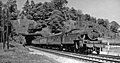
 Duffield (near) Fell diesel geograph-2390450-by-Ben-Brooksbank.jpg 2,016 × 1,448; 993 KB
-
 Duffield - Emmanuel Christian Centre - geograph.org.uk - 1563380.jpg 640 × 480; 86 KB
-

-
 Duffield - Fisher Lane - geograph.org.uk - 1563373.jpg 640 × 480; 84 KB
-
 Duffield - Flaxholme highways depot - geograph.org.uk - 2828941.jpg 1,600 × 1,244; 524 KB
-
 Duffield - footpath from Church Walk to Makeney Road - geograph.org.uk - 2829952.jpg 1,200 × 1,600; 730 KB
-
 Duffield - Ivy House on Town Street - geograph.org.uk - 1563360.jpg 640 × 473; 87 KB
-
 Duffield - Makeney Road to west of Derwent Bridge - geograph.org.uk - 2829956.jpg 1,199 × 1,600; 767 KB
-
 Duffield - No 55 Town Street - geograph.org.uk - 1563353.jpg 640 × 480; 97 KB
-
 Duffield - Patten Makers Arms - geograph.org.uk - 1563367.jpg 640 × 480; 92 KB
-
 Duffield - Poterills Alms Houses - geograph.org.uk - 2829948.jpg 1,600 × 1,200; 624 KB
-
 Duffield 2 railway geograph-2165224.jpg 1,024 × 626; 329 KB
-
 Duffield Bank - geograph.org.uk - 5560324.jpg 2,000 × 1,333; 2.31 MB
-
 Duffield Baptist Church.jpg 4,032 × 3,024; 5.41 MB
-
 Duffield church - geograph.org.uk - 4696423.jpg 640 × 480; 27 KB
-
 Duffield cottages.jpg 1,629 × 998; 204 KB
-
 Duffield fire station - geograph.org.uk - 215821.jpg 640 × 427; 176 KB
-
 Duffield Methodist Church - geograph.org.uk - 2385458.jpg 640 × 427; 93 KB
-
 Duffield Methodist Church - geograph.org.uk - 2385462.jpg 640 × 427; 69 KB
-
 Duffield milepost.jpg 4,032 × 3,024; 1.74 MB
-
 Duffield MMB 01 Ecclesbourne Valley Railway 79900.jpg 3,555 × 2,524; 4.48 MB
-

-
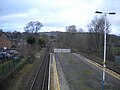
 Duffield Station - geograph.org.uk - 5817781.jpg 1,024 × 768; 444 KB
-
 Duffield Tamworth Street.jpg 1,629 × 1,020; 576 KB
-
 Duffield up freight on Midland main line geograph-2760565-by-Ben-Brooksbank.jpg 2,394 × 1,267; 2.1 MB
-
 Duffield, Derbyshire ... the Post Office with DE56 239 (6198590877).jpg 2,952 × 2,332; 2.98 MB
-
 Duffield, St Alkmund - geograph.org.uk - 6360731.jpg 3,000 × 4,000; 3.87 MB
-

-

-
 Ecclesbourne Valley Railway - geograph.org.uk - 225382.jpg 640 × 480; 116 KB
-

-
 Emmanuel Christian Centre, 32 Chapel Street, Duffield - geograph.org.uk - 4425253.jpg 5,184 × 3,456; 5.85 MB
-
 Entering Duffield - geograph.org.uk - 3996022.jpg 640 × 480; 60 KB
-
 Evangelical Baptist Church - geograph.org.uk - 2643091.jpg 1,024 × 768; 202 KB
-
 Farm entrance off Burley Hill north of Allestree - geograph.org.uk - 6359272.jpg 1,024 × 768; 263 KB
-
 Farmland near Duffield - geograph.org.uk - 2964792.jpg 800 × 585; 79 KB
-
 Farmland near Duffield - geograph.org.uk - 3996021.jpg 640 × 480; 67 KB
-
 Farmland, Broom Park - geograph.org.uk - 3996028.jpg 640 × 480; 76 KB
-
 Farnah Lodge, with VR post box - geograph.org.uk - 2144465.jpg 640 × 480; 132 KB
-
 Fishing peg number on the Derwent - geograph.org.uk - 2384151.jpg 427 × 640; 127 KB
-
 Foot crossing west of Duffield - geograph.org.uk - 3661670.jpg 1,600 × 1,200; 882 KB
-
 Footbridge over a drain - geograph.org.uk - 5225482.jpg 1,280 × 960; 664 KB
-
 Footbridge over the River Ecclesbourne - geograph.org.uk - 4548484.jpg 1,024 × 615; 104 KB
-
 Footpath crosses the Ecclesbourne Valley Railway - geograph.org.uk - 4899745.jpg 2,000 × 1,500; 279 KB
-
 Footpath crossing the Ecclesbourne Valley Railway - geograph.org.uk - 3661665.jpg 1,600 × 1,200; 901 KB
-
 Footpath Junction at Chevinend - geograph.org.uk - 3942698.jpg 3,900 × 2,862; 2.11 MB
-
 Footpath off Cavendish Close, Duffield - geograph.org.uk - 6363305.jpg 1,024 × 768; 148 KB
-
 Footpath through the golf course north of Duffield - geograph.org.uk - 3661660.jpg 1,600 × 1,200; 840 KB
-
 Footpath to Derby Road - geograph.org.uk - 5195833.jpg 1,280 × 960; 544 KB
-
 Footpath to Wirksworth Road, Duffield - geograph.org.uk - 6363302.jpg 1,024 × 768; 132 KB
-
 Footpath up the bank at Duffieldbank - geograph.org.uk - 5842193.jpg 1,280 × 960; 621 KB
-
 Footpaths meet in Duffield meadow - geograph.org.uk - 2144556.jpg 640 × 480; 51 KB
-
 Former bank, now marketing agency, Duffield - geograph.org.uk - 5535020.jpg 1,600 × 1,195; 683 KB
-
 Former HSBC bank in Duffield - geograph.org.uk - 2385445.jpg 640 × 427; 84 KB
-
 Fp to Chevin 058126.jpg 640 × 268; 56 KB
-
 Glysophate versus Japanese Knotweed - geograph.org.uk - 2144559.jpg 640 × 480; 137 KB
-
 Grazing Land at Duffieldbank - geograph.org.uk - 3942983.jpg 3,866 × 2,812; 1.41 MB
-
 Hazelwood Lane - geograph.org.uk - 5844931.jpg 2,000 × 1,333; 2.39 MB
-
 Hazelwood Road towards Spring Hill - geograph.org.uk - 3661662.jpg 1,600 × 1,200; 580 KB
-
 Holloway Road, Duffield - geograph.org.uk - 2386050.jpg 640 × 427; 115 KB
-
 Holloway Road, Duffield - geograph.org.uk - 2475020.jpg 640 × 480; 71 KB
-
 Holloway Road, Duffield - geograph.org.uk - 2475021.jpg 640 × 480; 65 KB
-
 Houses off Broadway, Duffield - geograph.org.uk - 3996025.jpg 640 × 480; 59 KB
-
 Houses on Derby Road, Duffield - geograph.org.uk - 4330155.jpg 1,600 × 1,351; 681 KB
-
 Houses on Ecclesbourne Avenue, Duffield - geograph.org.uk - 4330141.jpg 1,600 × 1,095; 524 KB
-
 Lab hallway.jpg 4,609 × 2,592; 2.43 MB
-
 Lane to South Duffield Hall - geograph.org.uk - 1552812.jpg 640 × 480; 63 KB
-

-
 Low rise flats on New Zealand Lane, Duffield - geograph.org.uk - 6363310.jpg 1,024 × 768; 140 KB
-
 Masonic Hall, Duffield - geograph.org.uk - 2385488.jpg 427 × 640; 77 KB
-
 Midland Main Line - geograph.org.uk - 4695914.jpg 640 × 480; 49 KB
-
 Midland Railway near Little Eaton - geograph.org.uk - 145018.jpg 640 × 480; 160 KB
-
 Milford Road, Duffield - geograph.org.uk - 1831904.jpg 640 × 480; 62 KB
-
 Milford Tunnel 2 geograph-2201996.jpg 1,024 × 540; 262 KB
-
 Moated site west of Farnah Hall - geograph.org.uk - 221634.jpg 640 × 465; 107 KB
-
 Net Practice - geograph.org.uk - 2385433.jpg 640 × 421; 95 KB
-
 New house Hazelwood Road, Duffield - geograph.org.uk - 2475019.jpg 640 × 480; 66 KB
-
 New house, Snake Lane, Duffield - geograph.org.uk - 2475023.jpg 640 × 480; 64 KB
-
 North end of Duffield railway station - geograph.org.uk - 6363292.jpg 1,024 × 768; 151 KB
-
 North west end of Hall Farm Road, Duffield - geograph.org.uk - 6363313.jpg 1,024 × 768; 129 KB
-
 Off Eaton Bank - geograph.org.uk - 5560308.jpg 2,000 × 1,333; 2.85 MB
-
 Old and new at Duffield Station - geograph.org.uk - 5638570.jpg 852 × 1,280; 265 KB
-
 Old Milepost by the A6 (geograph 5623822).jpg 954 × 1,468; 220 KB
-
 Old Milepost by the A6, Derby Road, Duffield (geograph 5623823).jpg 954 × 1,254; 163 KB
-
 Old Milepost by the B5023, Broadway, Duffield (geograph 5623809).jpg 954 × 1,393; 172 KB
-
 Opticians on Town Street - geograph.org.uk - 2643113.jpg 1,024 × 768; 136 KB
-
 Outside Duffield - geograph.org.uk - 2194811.jpg 1,024 × 768; 164 KB
-
 Pavilion, Duffield Cricket Club - geograph.org.uk - 2385428.jpg 640 × 427; 54 KB
-
 Peckwash Paper Mill, aerial 2014 - geograph.org.uk - 3929691.jpg 640 × 427; 81 KB
-
 Peckwash Paper Mill, aerial 2014 - geograph.org.uk - 3929693.jpg 640 × 427; 67 KB
-
 Pedestrian tunnel - geograph.org.uk - 2385438.jpg 640 × 427; 114 KB
-
 Pipe bridge over the Derwent - geograph.org.uk - 2385420.jpg 640 × 427; 120 KB
-
 Ponies and houses on Duffieldbank - geograph.org.uk - 2031897.jpg 640 × 480; 92 KB
-
 Practice Area and First Tee at Chevin Golf Club - geograph.org.uk - 3942714.jpg 3,834 × 2,764; 1.36 MB
-
 Public Footpath, Derby Road, Duffield, Derbyshire - geograph.org.uk - 1817463.jpg 1,200 × 1,600; 361 KB
-

-
 Railway lines, Duffield - geograph.org.uk - 2475015.jpg 640 × 480; 106 KB
-
 Railway lines, Duffield - geograph.org.uk - 2475016.jpg 480 × 640; 102 KB
-
 Remains of Duffield Castle - geograph.org.uk - 3942976.jpg 4,000 × 3,000; 2.24 MB
-
 Ridge and furrow field - geograph.org.uk - 5225489.jpg 1,440 × 1,080; 575 KB
-
 Ridge and furrow field with pheasants - geograph.org.uk - 5204985.jpg 1,280 × 960; 560 KB
-
 River Ecclesbourne - geograph.org.uk - 225386.jpg 640 × 480; 122 KB
-
 River Ecclesbourne, Duffield - geograph.org.uk - 6363297.jpg 1,024 × 768; 197 KB
-
 Road bridge over railway near Duffield church.jpg 4,032 × 3,024; 2.12 MB
-
 Road works, Duffield - geograph.org.uk - 2144561.jpg 640 × 480; 61 KB
-
 Roadside Oak - geograph.org.uk - 1101568.jpg 640 × 426; 71 KB
-
 Sheep pastures, Ecclesbourne valley - geograph.org.uk - 4548487.jpg 1,024 × 614; 112 KB
-
 Southern half of Devonshire Drive, Duffield - geograph.org.uk - 6363309.jpg 1,024 × 768; 138 KB
-
 St Alkmund's Church - Duffield - July 2018 (1) - geograph.org.uk - 5846114.jpg 4,409 × 6,723; 2.95 MB
-
 St Alkmund's Church - Duffield - July 2018 (2) - geograph.org.uk - 5846116.jpg 4,687 × 7,047; 3.3 MB
-
 St Alkmund's Church - Duffield - July 2018 (3) - geograph.org.uk - 5846119.jpg 7,152 × 4,722; 3.64 MB
-
 St Alkmund's Church - Duffield - July 2018 (4) - geograph.org.uk - 5846120.jpg 6,905 × 4,912; 2.75 MB
-
 St Alkmund's Church - Duffield - July 2018 (5) - geograph.org.uk - 5846125.jpg 7,159 × 4,758; 2.62 MB
-
 St Alkmund's Church - Duffield - July 2018 (6) - geograph.org.uk - 5846142.jpg 2,841 × 4,584; 1.57 MB
-
 St Alkmund's Church - Duffield - July 2018 (7) - geograph.org.uk - 5846131.jpg 3,991 × 3,715; 2.24 MB
-
 St. Margaret Clitherow - geograph.org.uk - 5199062.jpg 1,280 × 960; 377 KB
-
 Station Approach, Duffield - geograph.org.uk - 2118163.jpg 640 × 480; 92 KB
-
 Station Road, Duffield - geograph.org.uk - 6363294.jpg 1,024 × 768; 138 KB
-
 Stile on Centenary Way - geograph.org.uk - 2144552.jpg 640 × 480; 113 KB
-
 Stone terrace houses, Makeney - geograph.org.uk - 284936.jpg 640 × 429; 143 KB
-
 Stones in the River Derwent - geograph.org.uk - 2384054.jpg 640 × 427; 120 KB
-
 Stream beside Duffield Station - geograph.org.uk - 3919742.jpg 640 × 427; 137 KB
-
 Tamworth Street, Duffield - geograph.org.uk - 2386054.jpg 640 × 427; 91 KB
-
 The Bridge Inn - geograph.org.uk - 2643064.jpg 1,024 × 768; 226 KB
-
 The Bridge Inn-River Derwent, Duffield, Derbyshire - geograph.org.uk - 1829072.jpg 1,600 × 1,200; 243 KB
-
 The Centenary Way at Duffield Meadows - geograph.org.uk - 3594162.jpg 4,000 × 3,000; 2.31 MB
-

-
 The Derwent Meanders past Duffield - geograph.org.uk - 1102993.jpg 640 × 426; 104 KB
-
 The Duffield (west) milepost - detail - geograph.org.uk - 1703953.jpg 691 × 922; 187 KB
-

-
 The Ecclesbourne Valley Railway - geograph.org.uk - 2383896.jpg 640 × 427; 121 KB
-
 The Ecclesbourne Valley Railway - geograph.org.uk - 2383974.jpg 640 × 424; 142 KB
-
 The Forge, Driffield.jpg 640 × 640; 357 KB
-
 The former New Inn - geograph.org.uk - 5204936.jpg 1,280 × 960; 330 KB
-
 The Kings Head, Duffield - geograph.org.uk - 4330140.jpg 1,600 × 1,067; 799 KB
-
 The Midshires Way near Duffield - geograph.org.uk - 3492623.jpg 4,000 × 3,000; 2.43 MB
-
 The Pastures - geograph.org.uk - 5359471.jpg 1,600 × 1,200; 553 KB
-
 The Pattenmakers Arms, Duffield - geograph.org.uk - 4349509.jpg 1,280 × 851; 386 KB
-
 The Pattenmakers Arms, Duffield - geograph.org.uk - 4350596.jpg 1,280 × 851; 390 KB
-
 The Patternmaker's Arms - geograph.org.uk - 2385498.jpg 640 × 427; 93 KB
-
 The Patternmaker's Arms - geograph.org.uk - 2385501.jpg 640 × 427; 99 KB
-
 The River Derwent - geograph.org.uk - 1016140.jpg 640 × 426; 227 KB
-
 The River Derwent - geograph.org.uk - 2384024.jpg 427 × 640; 148 KB
-
 The River Derwent - geograph.org.uk - 2384064.jpg 640 × 427; 115 KB
-
 The River Derwent - geograph.org.uk - 2384196.jpg 640 × 421; 125 KB
-
 The River Derwent - geograph.org.uk - 2385191.jpg 640 × 427; 126 KB
-
 The River Derwent and Bridge Inn - geograph.org.uk - 1016137.jpg 640 × 426; 216 KB
-
 The River Derwent and Duffield Bank - geograph.org.uk - 2384427.jpg 427 × 640; 104 KB
-

-
 The River Ecclesbourne - geograph.org.uk - 2144468.jpg 640 × 480; 112 KB
-
 The River Ecclesbourne - geograph.org.uk - 2383947.jpg 640 × 427; 141 KB
-
 The River Ecclesbourne - geograph.org.uk - 2386059.jpg 640 × 427; 112 KB
-
 The River Ecclesbourne near Duffield - geograph.org.uk - 3594180.jpg 4,000 × 3,000; 3.34 MB
-
 The Sign of the White Hart, Duffield - geograph.org.uk - 1108475.jpg 437 × 640; 78 KB
-
 The view from Duffieldbank - geograph.org.uk - 2031892.jpg 640 × 480; 78 KB
-
 The White Hart, Duffield - geograph.org.uk - 1108480.jpg 640 × 426; 98 KB
-

-
 Trees along the River Ecclesbourne - geograph.org.uk - 4548480.jpg 1,024 × 615; 172 KB
-
 Useless gate on a path by the railway - geograph.org.uk - 5209806.jpg 1,280 × 960; 719 KB
-
 West end of Curzon Lane, Duffield - geograph.org.uk - 6363303.jpg 1,024 × 768; 147 KB
-
 Winter Scene near Quarndon - geograph.org.uk - 4269603.jpg 4,000 × 3,000; 3.1 MB
-
 Wirksworth Road (B5023) - geograph.org.uk - 3996030.jpg 640 × 480; 74 KB
-
 Wirksworth Road Duffield - geograph.org.uk - 5560301.jpg 2,000 × 1,333; 2.84 MB
-
 Champion Farm - geograph.org.uk - 180342.jpg 640 × 480; 101 KB


_-_geograph.org.uk_-_6359266.jpg)


_Fell_diesel_geograph-2390450-by-Ben-Brooksbank.jpg)


.jpg)


.jpg)
.jpg)
.jpg)


_-_geograph.org.uk_-_5846114.jpg)
_-_geograph.org.uk_-_5846116.jpg)
_-_geograph.org.uk_-_5846119.jpg)
_-_geograph.org.uk_-_5846120.jpg)
_-_geograph.org.uk_-_5846125.jpg)
_-_geograph.org.uk_-_5846142.jpg)
_-_geograph.org.uk_-_5846131.jpg)


_milepost_-_detail_-_geograph.org.uk_-_1703953.jpg)
_milepost_in_its_setting_-_geograph.org.uk_-_1703950.jpg)


_-_geograph.org.uk_-_3996030.jpg)

